
The Best View of New York Is From a Run Across the River in New Jersey

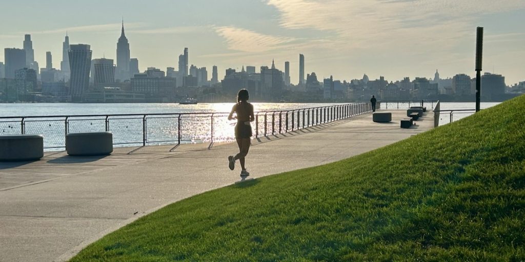
To run with the Manhattan skyline in view, the stage is not New York. It is New Jersey, across the river. A waterfront path runs along the western shore of the Hudson River from Bayonne to the George Washington Bridge. Called the Hudson River Waterfront Walkway, it stretches 18.6 miles in a straight line, and the actual distance on foot, winding around piers and marinas, runs past 30 miles. The project began under a 1984 state law that required developers building within 100 feet of the water to set aside a public space at least 30 feet wide, and the path was pieced together segment by segment. It is now about 85 percent complete, and at the gaps that remain, runners detour briefly onto the road.
Run toward the northern bridge and the skyline stays at your side the whole way. From south to north, ten stops stand out for runners chasing the view.
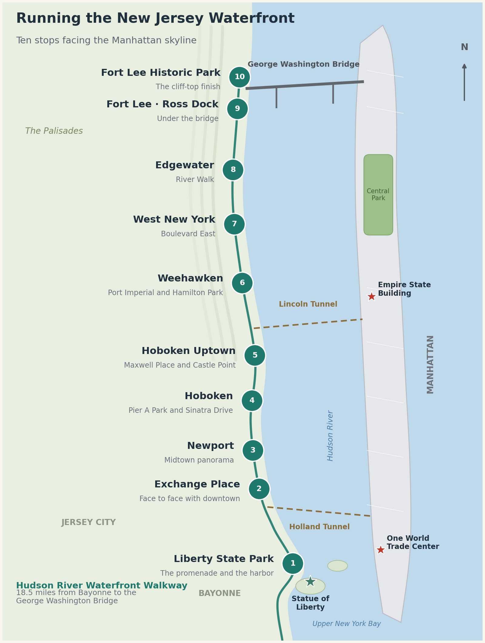
Liberty State Park. The start is Liberty State Park in Jersey City. Along the Liberty Walk promenade, about 2 miles long, the harbor and Lower Manhattan open straight ahead, with the Statue of Liberty and Ellis Island entering the frame in profile. The park is open from 6 a.m. to 10 p.m., and parking is plentiful. The Hudson-Bergen Light Rail’s Liberty State Park station sits close to the entrance.
Exchange Place. No point faces the World Trade Center more closely or more squarely. Run out along the pier promenade that reaches toward the river from the plaza in front of the PATH station, and downtown seems close enough to touch. It is one stop and five minutes by PATH to the World Trade Center. This is a stretch to reach by train rather than by car.
Newport. Across the river, Midtown spreads out wide. The Empire State Building and the Hudson Yards area stand in front, and a turn of the head to the south picks up downtown beyond them. Newport Green park holds the only urban beach on the Hudson River, along with a red lighthouse. Both the PATH Newport station and the light rail Newport station serve the neighborhood.
Hoboken, Pier A and Sinatra Drive. On this stretch, Midtown stands directly ahead. Circle the lawn of Pier A Park and run along Sinatra Drive, and the Empire State Building stays in front of your eyes. Hoboken Terminal is a five-minute walk away, putting PATH, commuter trains and ferries all within reach at once. It is the most accessible point on the path.
Hoboken Uptown, Maxwell Place and Castle Point. At river level, Maxwell Place Park gives uptown Hoboken its view, but the true single-frame picture waits on the hill. Climb to the Castle Point lookout on the Stevens Institute of Technology campus, and the whole skyline, from the Empire State Building to the World Trade Center, fits in one frame, with the Statue of Liberty visible in the distance. The lookout sits on a college campus, but it is open to everyone.
Weehawken, Port Imperial. At river level stands a 9/11 memorial raised from steel columns of the World Trade Center, and Weehawken Waterfront Park has a 400-meter running track. It is a rare place on this path where a runner can chase a time while taking in the scenery. Climb to Hamilton Park on the cliff and Midtown spreads out below, seen from the ground where the Hamilton and Burr duel was fought. Steep stairways link the riverfront and the cliff. The ferry reaches Midtown in eight minutes.
West New York, Boulevard East. Here the stage is a wide sidewalk along a cliff-top road. From more than 150 feet above the river’s surface, Midtown opens in a panorama, and the farther north you run, the more the George Washington Bridge enters the view. This is not a closed path, though. It is a sidewalk beside a road with moving traffic, a stretch where runners carry the scenery and a measure of vigilance at the same time.
Edgewater, River Walk. Across the river are Washington Heights and Inwood, and the George Washington Bridge fills the view to the north. Completed segments are flat pavement and boardwalk, good for running, but Edgewater is also the town with the most gaps in the walkway. Detouring onto the River Road sidewalk now and then is part of the true picture of this stretch. A flock of wild parakeets lives along the boardwalk in front of the shopping center.
Fort Lee, Ross Dock. Directly beneath the George Washington Bridge, this is the spot for looking up at the bridge from river level. The bridge itself becomes the scenery, and Upper Manhattan opens across the water. The walkway meets Palisades Interstate Park here, and from this point the route continues on the park’s trails. Parking is metered, and the park warns that the riverside lot can take on water at high tide.
Fort Lee Historic Park. The finish is on top of the cliff. The historic park at the bridge’s western end stands on the restored site of a Revolutionary War encampment, and from its viewpoint the George Washington Bridge and Upper Manhattan are caught in a single frame. The run that began at river level ends on the cliff top. No rail line and no ferry reach this stop, which makes it the hardest of the ten to get to without a car.
The ten stops share one thing. The New York skyline is seen better from across the river than from inside New York. As a stage for a run, nothing more needs to be said.